WHY WAS THE PROJECT NEEDED?
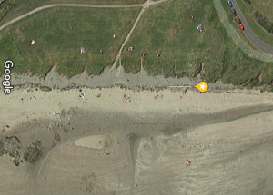
Satellite View before restoration showing no dunes left and lots of unofficial routes onto the beach
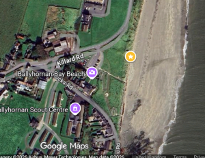
2025 satellite image showing dunes regrown and 2 protected access paths to beach
Uncontrolled access by quads and motorbikeshad completely destroyed 300 meters of dunes on Ballyhornan Beach. Erosion was spreading to undercut the cliffs and threaten the coastal road into the village. Historically the original play area and car-park had been lost to the sea and the meadow used by visitors to enjoy the beach was now being undercut in the absence of dunes on the seaward side.
MAP AND PERMISSIONING FOR AREAS AGREED FOR RESTORATION
 Lecale Conservation’s Cadogan Enright worked with Councils Biodiversity officer Danielle Begley and the Department of the environment agree to the scope of the project. Phase 1 of the Ballyhornan Beach project was to re-grow the dunes and push the sea back away from the beach on the Western side of Ballyhornan beach. We also attempted to protect the area of the cliffs under the road into the village.
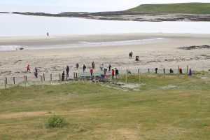
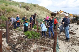
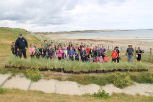
GATHERING SEA WEED AND PLANTING DUNE GRASSES
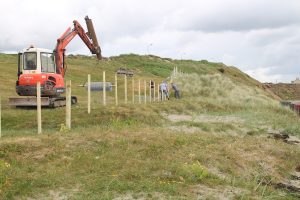
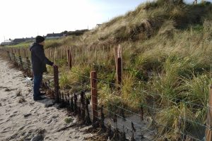
Posts installed beforehand
2. The area where the dunes were to be grown had all the posts for the front fence and chestnut palings put in beforehand to ensure the plantings would not be damaged. We used local farmers who were used to working in coastal areas and whom Lecale Conservation had paid to attend specialist courses on fencing for dunes. They knew what type and size of post and how they should be treated to suvive 10 to 20 years in salt water conditions. This is important as posts on other beaches intsalled by Council were rotten or broken within 18 months. These posts are still in good condition 14 years later.
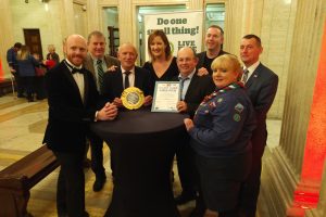 A few words from speaches at the awards cermony
“The Downpatrick and Lecale area is the lowest-lying electoral area in Northern Ireland, surrounded on all sides by water. Meteorologists are constantly revising upwards the impacts upon our coast of climate change. Increased storminess, flooding and erosion are expected. It is clear that, to date, there has been little acknowledgement of these issues from Government in NI. Unlike the devolution settlement in Wales and Scotland this responsibility has not been clearly allocated to either a NI or a Westminster Government department”.
 “Most people in Northern Ireland live or work in coastal areas. This makes our coast one of our most important assets, contributing both to the economy and the quality of life. But we face rapidly increasing risks from coastal erosion and marine flooding.”
“The National Trust is proposing a system of government funded coastal monitoring as in the Republic, Scotland, England and Wales. This would provide an evidence base to develop a ‘National Coastal Change Assessment’ for Northern Ireland and establishing a system of Shoreline Planning in the public domain. It is embarrassing that NI Inc. is only starting to think about this.”
 “About 32% of Northern Ireland’s coastline is rock-armoured. Unlike the rest of the UK, no one government department is in charge of maintaining and caring for this legacy of centuries of coastal protection work. In the absense of any department being in charge here, we have what is called ‘the Bateman formula’. This makes each department responsible for their own assets, but makes no-one responsible for miles of legacy coastal protection. Increasingly there is a recognition that armouring the coast is a second-best solution to more natural sea defences like protecting and encouraging growth of sand-dune systems.”
BEFORE AND AFTER
Here you can see a before video of Ballyhornan Phase 1 when the dunes had completly gone
Here you can see the drastic improvements after 6 months in this ‘after’ video: (update in 2025 – thiese dunes are now 6 to 8 feet tall)