TYRELLA BEACH RESTORATION PHASE 1

WHY THE PROJECT WAS NEEDED
Tyrella beach is one of the top 5 visitor beaches in Northern Ireland. It is Jointly owned and managed by Newry Mourne and Down Council (NM&D) and the NI Department of the Environment (DAERA).
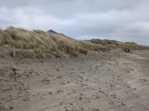
The front edge of the sand dunes had become badly eroded from public footfall, losing the front 3 layers of dune species and exposing the rear marram layer to the tides. The rear Marram layer was being undercut and falling into the sea. Multiple forced access points though the dunes were opening up gaps that caused ‘blow-outs’.
Freshwater ponds in the dunes shelter NI’s largest population of Irish newt and the dunes also shelter NI’s largest concntration of the Irish Lizard. The beach is an ASSI.
 Lecale Conservation Association received funding from the Department of Infrastructure (DfI) ‘Living Places and Spaces Fund’ which has enabled it to continue an ongoing project of sand dune restoration at Tyrella Beach on the Lecale Coast.
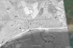
Satellite photo before phase 1
SATELLITE PHOTOS
The area around the old visitors’ centre was particularly badly eroded.
See the following satellite pictures showing the situation before and after Tyrella Phase 1.
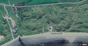
West Side of Beach after Phase 1
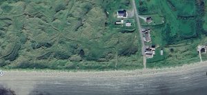
East Side of Tyrella Beach after phase 1
PROJECT LED BY LOCAL NGO’S AND SUPPORTED BY COUNCIL AND DEPARTMENT

NGO Lecale Conservation’s project leader Cadogan Enright https://lecaleconservation.org/ worked with NM&D Council and DAREA to gain permissions to create a 2 stage project to remediate the beach over 3 years.
A cocktail of funding was organised by Lecale Conservation and NM&D Council to fund the 2 separate phases. Lecale Conservation raised the money for phase 2 and assited NM&D Council in raising the money for phase 1.
NGO True Harvest Seeds was contracted for 3 years to gather seed, propagate and grow the necessary for the project. https://trueharvestseeds.org/
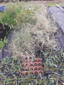
True Harvest Seeds grow both the 3 dune grasses needed to restore dunes as well as 13 other species for restoring diversity after front edge is restored
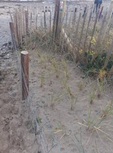
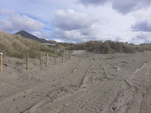
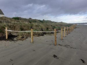
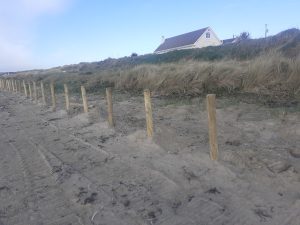
Phase 1 in 23/24 was to reestablish the front line of the dunes behind a rope fence, robustly fence off the rear of the beach to prevent uncontrolled access to the dunes system and to strongly reenforce and replant 5 entrances from the rear parking and walking area to create easy visitor access .
Phase 2 was to create as second layer of dunes towards the sea. This 250 meter section had been badly eroded around the old visitors centre which was demolished prior to phase 2 in 2025.
At every stage we involved the Strangford and Lecale Coast AONB team and the Geopark staff
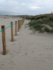
FENCING FOR CONTROLLED ACCESS & PUBLIC INFORMATION ON RESTORATION
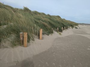
Entrances to beach restored and proteced by both sheepwire fencing and 90 degree zigzag split chestnut palings for rapid strong regowth
A contractor was employed to fence the front and back of the dunes to prevent uncontrolled access. In the second phase we used a specialist contractor Natural Sea Defences. This contractor was able to bring years of exerience to the project and add much value.
5 convenient beach access points were reinforced with chestnut palings and fencing to create strong-points in the dunes and connected to an agreed path network to the carpark.
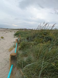
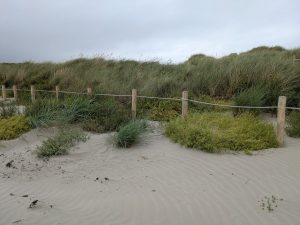
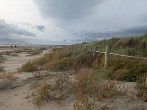
At the front edge of the dunes, space was left behind a simple rope fence to allow the re-establishment of the lyme and sand couch grasses that halt erosion and build new dunes in front of the marram layer.
Space was left behind a simple rope fence to restore the front layers of the beach to protect the rear marram layers
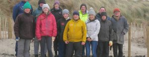
Cadogan Enright on behalf of Lecale Conservation and Debbie Gillis of True Harvest organised volunteer days for local community groups to plant sand couch and Lyme Grass layers with some marram use to plug gaps where blowouts had occurred.
Information signs explaining what was going on to public were agreed and the public was asked for help.
WHAT WERE THE OUTCOMES OF PHASE 1 OF THE PROJECT?
- In front of old visitors’ centre before and after
old visitor centre before
old visitor centre after
- Main Beach West side before and after

West Side before
West side after phase 1
- Second entrance before and after
second entrace before phase 1
Second entrance after phase 1
4. East Side of beach near first house
near first house before phase 1
Near first house after phase 1
WHAT WE COULD HAVE DONE BETTER?
On the Eastern Side of where phase 2 now joins phase 1, the initial fencing contractor installed the fencing too close to the marram layer for about 200 meters (out of 1500 meters). This meant we did not have enough space free from public footfall to plant the full required protective layers of lyme and couch to protect the marram.
This error occurred as the contactor followed the line of erosion, rather than the natural line of the beach. We attempted to fix this with the second phase projecting more onto the beach and trying to even up the inward curve caused by erosion at the old visitors centre and move toward the high tide mark. However there is a section after phase 2 where the marram is too far forward. If funding could be secured for a phase 3 we could tackle this by moving the dunes line towards the sea bey 3 to 5 meters creating 6000 square meters more natural habitat.